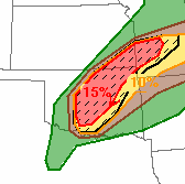
I figured that the southern most cell would become dominant and we targeted this cell. We made it into Minco and headed north on Hwy 81. I wanted to position to the SE of the storm base so I told Daniel to turn west on Reno Rd. I thought that the storm would track in an easterly fashion and at a chaseable rate of speed given what I saw on the special 18Z OKC sounding:
 |
Note the extreme sfc CAPE (~5000 J/kg), low LCL, and Bunker's right storm motion vector of 260° @ 21 kts!
|
Here is a map showing times and locations over the course of chasing what would be known as the El Reno tornado.
I began filming at 5:53:14 just west of Choctaw Ave. The striated base was huge! Without a doubt the most visually impressive storm that i had ever seen!
We couldn't make out the wall cloud yet. We would eventually see it in a few minutes to our NW. (© Daniel Rodriguez)
When we stopped at the intersection of S Airport Rd/Reno Rd at 5:58 pm, the rapidly rotating wall cloud was approximately 6-8 miles to our WNW. I assumed that we were in good position if the wall cloud continued on it's easterly track. We set up shop and began to film at 6:03:53 pm. I had never witnessed such violent motion before!
Filmed from S Airport Rd/Reno Rd intersection from 6:03:53-6:10:04 pm.
 |
| 0.5° BR and SRV image @ 06:05:23 pm. Our location denoted by white "X". |
Surprisingly, the tornado began tracking to the SE and eventually crossed Reno Rd about 2-3 miles to our west. In hindsight, we should have repositioned then, but I still felt comfortable given the slower storm motion and grid road network. I figured we could shoot east and then north or south depending on tornado track. We stayed at that position and filmed until the rain curtains of the RFD began to near our position. The tornado was barely visible at this time but looked to be quickly growing into a large stovepipe tornado (later analysis of video shows a giant wedge in progress). Here are some screengrabs showing the tornado crossing Reno Rd:
 |
| Tornado N of Reno Rd (Time: 6:05:08 pm) |
 |
| Tornado crossing Reno Rd (Time: 6:08:02 pm) |
 |
Tornado S of Reno Rd (backlit by lightning; Time: 6:09:04 pm)
Note the tree being lofted in the air in foreground. |
 |
Wedge tornado SW (Time: 6:10:01 pm)
Look closely and note how quickly the tornado morphed into a large violent wedge! |
 |
| 0.5° BR and SRV image @ 06:09:57 pm. Our location denoted by white "X". |
As we traveled east on Reno Rd, we didn't encounter any traffic. I knew we had to quickly head east but was not that worried at the time. I figured we would quickly outpace the tornado as we traveled east. However, as I was peering out the side window I was amazed at how quickly the tornado was increasing in size by the time we were near Choctaw Ave (6:16:02 pm). At that time, I noticed wrapping rain curtains no more than a mile to the southwest of us. Also, it appeared that the tornado had shifted back to the north a bit and the center was closer to our 5 o'clock.
We continued east about another mile and were nearing our main N-S paved road option Highway 81. We were approximately a 1/4 mile west of 81 and trees on the side of the road were making it difficult to see the tornado. What I did notice between the trees was that the tornado had shifted a bit to the south again. I was able to take some more short footage of the tornado. Large subvortices were moving around the main circulation center.
About 1/4 mile west of Hwy 81. Filmed from 6:16:33-6:17:26 pm.
High Quality VIDEO
When we reached Hwy 81, we were stuck behind at least 5 cars that obviously didn't know how dire the situation was at the moment. It was obvious that we weren't going to be able to head south and beat the tornado, so I told Daniel to continue heading east. In hindsight, we should probably have headed north. However, I didn't want to get caught in the core and risk not seeing a tornado coming at us. I saw clearing to our east and so that's where we went. Daniel drove around the line of vehicles and we crossed 81.
We traveled no further than a 1/4 mile and I began videotaping what I thought was possibly the main tornado. It was a violently rotating stovepipe-shaped tornado and was heading quickly in our direction. I couldn't believe how quickly it was moving and was amazed at how fast it was closing on us (later analysis revealed that MVMC had accelerated to over 50 mph to the east!!). I told Daniel that "we have to get out of here!". I could see the inflow jet just to our south and the tornado was crossing Hwy 81 no more than a mile to our southwest. I'm pretty sure what I filmed was the exact moment that the Weather Channel chase truck was hit. Later on, I found out that this tornado was one of several subvortices moving around the main tornado (which had now grown to 2.6 miles wide!). These subvortices were moving at up to 150 mph within the parent tornadic circulation!
Filmed from Reno Rd, just east of Hwy 81 from
06:18:42-06:19:10 pm.
High Quality VIDEO
 |
| 0.5° BR and SRV image @ 06:19:11 pm. Our location denoted by white "X". |
We were quickly engulfed by the 100+ mph winds of the inflow jet and Daniel struggled to keep my truck on the road. Visibility was near zero at times and Daniel was using the line of trees on either side of the road to center himself so that we wouldn't go into the ditch. Even though Daniel had the pedal to the medal, we were only able to go 40 mph or so. We weren't gaining much ground on the tornado. Within a minute, the rear passenger window blew out on my truck and the Davis weather station was removed from my roof. This was near the Reno Rd/Alfadale Rd intersection. I believe that we were sideswiped by the inflow jet of the large subvortex that hit The Weather Channel truck. The next couple minutes were the scariest of my life. I just held on and hoped that Daniel could keep us on the road. We continued on within the inflow jet hoping that we wouldn't get rolled over. Thankfully, the tornado shifted to the north of Reno Rd and began tracking towards I-40.
Josh Wurman, Karen Kosiba, Paul Robinson, and Tim Marshall have put together an excellent research paper on the El Reno tornado. Here is a detailed graphic showing the track of the tornado/MVMC:
 |
| The black "X" represents the Reno Rd/Alfadale Rd intersection. |
As we cleared the strong inflow about 2 miles west of Banner Rd (our next paved N-S road option), I felt confident that we were safe. We turned south onto Banner Rd and started shooting video. Strong 60+ mph RFD winds began to slam us from the west and destroyed an old wooden barn a couple hundred feet to our south. So we quickly shot south and got out to film the massive wedge and its' subvortices. Unbelievably, it appeared that the entire mesocyclone had dropped to the ground! You could hear the audible roar of the tornado from several miles away! It was surreal! We also observed a small mid level funnel along the rfd gust front. It lasted for less than a minute.
Filmed just south of Reno Rd/Banner Rd intersection from 6:24:52-6:29:34 pm.
The tornado eventually became rain wrapped and was very difficult to see. We planned to reposition for another supercell that was developing to the west of El Reno. We headed south and and west back to Hwy 81. We found ourselves stuck in a huge traffic jam with an approaching mesocyclone from the west. We eventually crossed the Canadian river and headed to Minco. We positioned on the west side of Minco and filmed a large wall cloud to the NW of town. Eventually the storm became outflow dominant and we headed home.
Tragically, Tim Samaras, his son Paul, and Carl Young of the TWISTEX team were killed by the tornado near the intersection of Reuter Rd and Radio Rd. My heart goes out to his family and for others that were directly affected by this event.
Major kudos to Daniel for staying calm and driving us to safety. Unfortunately for Tim, Paul, and Carl this beast shifted quickly to the northeast. However, that shift in its' track probably saved our lives.
 |
| Damage to truck from tornado |


.PNG)


.PNG)


No comments:
Post a Comment