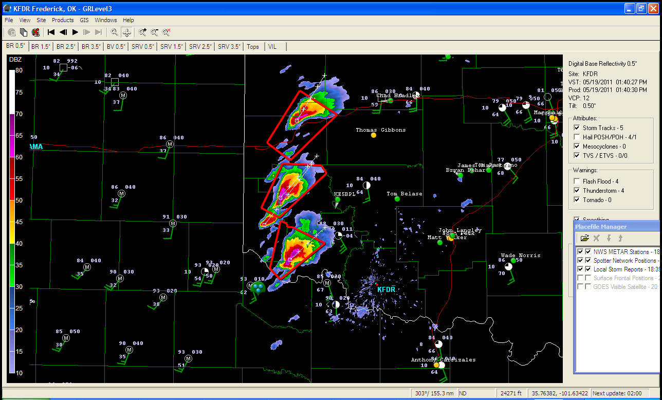
Models did well with dryline placement; not too well with convection though. I think the HRRR showed precip firing a little earlier than this closer to the SPS area. The storms are all rotating and are moving NE into a good environment. The dews are in the middle 60's with even 70 dews creeping up from SC OK. Backed sfc flow of 20+ kts and MLCAPE values of over 2500 J/kg, also LCL's below 1200 m all look enticing. 0-1 km shear is pretty weak (10-15 kt) but the environment to the NE of these does get better and the SPC's mesoanalysis shows 0-1 SRH values of 150 in WC and NW OK. The northern-most storm may be the good play at this point if these all stay discrete over time.
We will see.
Looks like a tornado report came from another cell that fired after the first 3 shown on the image.
ReplyDelete2310 3 SE FORT COBB CADDO OK 3507 9840 TWO METEOROLOGISTS OBSERVED A BRIEF TORNADO THAT LASTED LESS THAN ONE MINUTE. (OUN)